George VI-isen
Koordinatar:
| George VI-isen | |
| isbrem | |
 George VI-isen | |
| Land | |
|---|---|
| Stad | Palmer Land |
| - koordinatar | |
| Administrert under | Antarktistraktaten |
 George VI-isen (Antarktis) | |
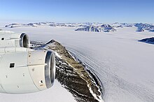
George VI-isen er ein stor isbrem som dekkjer George VI Sound mellom Aleksanderøya og Palmer Land i Antarktis. Isbremmen strekkjer seg frå Ronne Entrance, ved sørvestenden av sundet til Niznik Island, kring 55 km sør for det nordlege innløpet mellom Cape Brown og Cape Jeremy. Han vart namngjeve av UK Antarctic Place-Names Committee i samband med George VI Sound.[1]
Kjelder |
↑ «George VI Ice Shelf». Geographic Names Information System, U.S. Geological Survey. Henta 15. oktober 2012.
![]() Denne artikkelen inneheld stoff som er offentleg eige frå United States Geological Survey-artikkelen «George VI-isen» (innhald frå Geographic Names Information System).
Denne artikkelen inneheld stoff som er offentleg eige frå United States Geological Survey-artikkelen «George VI-isen» (innhald frå Geographic Names Information System).
|


